The Senate this week passed BAAJA, a large bipartisan permitting reform bill that CBS News says is designed to boost energy projects. Sen. Dan Sullivan of Alaska called it a historic package, and Utah Sen. Mike Lee and Gov. Spencer Cox backed it, the Deseret News reported. Outdoor Life says the bill will expedite development on public lands; Defenders of Wildlife called it deeply flawed and urged the House to stop it, and the Center for Western Priorities said Tribal concerns were not addressed. The Washington Times reports the House is likely to take up the Senate-passed bill without changes. Backcountry Hunters & Anglers has a summary of what it means for hunters and anglers.
A bill from Utah Sens. Mike Lee and John Curtis that would make Utah law, including its off-highway vehicle rules, govern motor vehicle use on 12 roads inside Capitol Reef National Park was reported to the full Senate with an amendment on Nov. 12 and placed on the calendar as No. 702. The roads in S. 2970 include the Burr Trail, Notom Bullfrog, Cathedral, Hartnet, Sulphur Creek and South Desert Overlook roads and Highway 24 within the park. No floor vote has been scheduled, Legis1 reported. Sen. Martin Heinrich, the Energy and Natural Resources Committee's ranking Democrat, has argued that all 12 roads are already open to conventional vehicles and that the change would strain emergency services and raise noise; the Off-Road Business Association backs the bill.
openEast Potomac Park south of Buckeye Drive, including Hains Point, Ohio Drive and the golf course groundsWashington, D.C.Temporary restraining order keeps it open through Nov 28 unless the court rules sooner; limited closures allowed for seawall repairs and safety; golf operations unclearchecked Nov 17
U.S. District Judge Ana C. Reyes on Nov. 14 issued a temporary restraining order blocking the National Park Service's planned Nov. 15 closure of East Potomac Park south of Buckeye Drive, WJLA reported. Hains Point, Ohio Drive, the waterfront paths and fishing areas must stay accessible through Nov. 28 unless the court rules again first; limited closures are allowed for active seawall repairs and imminent safety threats. Whether regular golf continues at the East Potomac course was left to the government and remained unclear.
advisorySeasonal closures on Game and Fish habitat management areasStatewide, WyomingDates vary by area. Vehicle closures already in force at Morgan Creek, Pennock Mountain, Kerns and Amsden Creek; no human presence at Greys River, Jackson and Pinedale areas from Dec. 1checked Nov 17
Some habitat areas are already closed to vehicles, and most of the big closures to all people begin Dec. 1. Not all of the agency's 500,000 acres close.
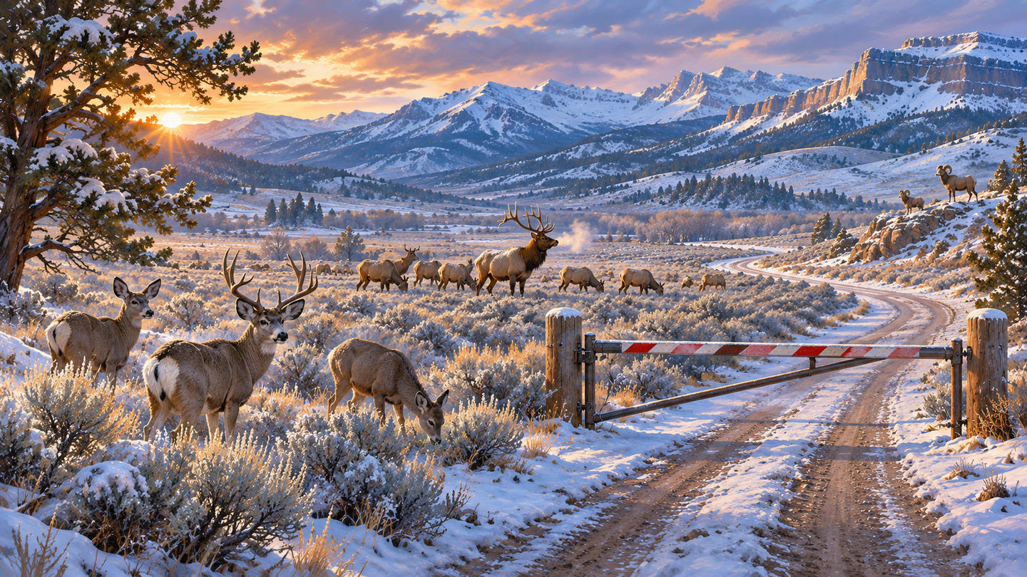
AI-generated editorial illustration of wildlife on Wyoming winter range. Illustration
The Wyoming Game and Fish Department's winter closures on its Wildlife Habitat Management Areas are under way, and most of the larger ones start Dec. 1. The closures keep people off winter range so deer, elk and bighorn sheep can reach forage without being pushed around.
A widely shared story this week said the closures shut 500,000 acres. That figure is the total area Game and Fish manages through its habitat areas, not the area that closes. Closure dates and rules differ by unit, and the department lists more than a dozen areas, including Ocean Lake, Table Mountain and Red Rim/Daley, that stay open all year, some with their own vehicle limits.
Some closures are already in force. Morgan Creek near Rawlins has been closed to vehicles since Nov. 1 and Pennock Mountain near Saratoga since Nov. 15. Kerns near Sheridan has been closed to vehicles since Nov. 1, and Amsden Creek near Sheridan closed to vehicles on Nov. 16. All four stay open to people on foot or horseback for now.
From Dec. 1 until 6 a.m. May 1, no one may enter Greys River near Alpine, Camp Creek and Horse Creek near Jackson, or Half Moon, Soda Lake, Fall Creek, Black Butte and Luke Lynch near Pinedale. Red Canyon near Lander closes to all people Dec. 1 through April 30, and Sunlight near Cody from 8 a.m. Dec. 16, though fishing on Sunlight Creek stays open. More areas close Jan. 1 and Feb. 1, including South Park near Jackson, Forbes/Sheep Mountain near Albany and Pilot Hill near Laramie.
Shed hunters and hikers should check each area's dates on the Game and Fish public access page before going. Closures generally run into May or June.
Olympic National Park is asking the public to review preliminary designs for a new visitor center at Hurricane Ridge, the park said Monday. The comment period runs from Nov. 16 through Dec. 16.
The plans include restrooms, visitor information and exhibit space, concession operations, and indoor and outdoor space for year-round use, including park programs and stargazing. The park says the building would also support emergency response and winter recreation on the ridge.
The designs are in an online newsletter, and comments can be sent through the National Park Service's planning site at parkplanning.nps.gov/HurricaneRidgeVisitorCenter. The park says comments will be considered as the project moves into its next design phase.
Park staff will present the designs and take questions at a virtual public meeting on Tuesday, Dec. 1, from 6 to 7 p.m. Pacific, on Microsoft Teams or by phone; joining details are on the park's announcement.
The new building replaces the Hurricane Ridge Day Lodge, which burned on May 7, 2023. The park's investigation did not find a definite cause.
noticeComment period: Class 1 e-bikes on BLM mountain bike trailsColorado River Valley Field Office (Glenwood Springs, Rifle and Eagle area), ColoradoDraft EA out Nov. 13. Proposed action adds 118 miles; a second alternative adds 187. Comments due Dec. 14 on BLM ePlanningchecked Nov 16
A draft environmental assessment for the Colorado River Valley Field Office would let Class 1 e-bikes onto mountain bike trails now closed to them. Comments are due Dec. 14.
The Bureau of Land Management's Colorado River Valley Field Office, based in Silt, has released a draft environmental assessment on letting Class 1 e-bikes ride more of its designated mountain bike trails, and is taking comments until Dec. 14.
Class 1 e-bikes give motor assistance only while the rider pedals, and stop assisting at 20 mph. The field office manages more than 220 miles of designated single-track mountain bike trails, and Class 1 e-bikes are allowed today on only about 18 miles of them, in the Grand Hogback Trail System north of Rifle.
The draft weighs three options. The BLM's proposed action would open 118 more miles of existing trails in designated recreation areas and near the Hardscrabble–East Eagle Special Recreation Management Area. A second alternative would open 187 more miles. A no-action alternative would leave current e-bike rules as they are. Current trail designations stay in place until a final decision.
When the BLM first asked for input this spring, supporters said e-bikes would open the trails to riders of different ages and abilities. Others raised trail user conflicts, wildlife disturbance, enforcement and sensitive areas, and some suggested limiting e-bikes to certain trails or making some routes one-way. "Every trail system is different, and what works in one area may not work in another," said Alan Czepinski, an outdoor recreation planner for BLM Colorado.
The draft assessment, maps and comment form are on the project's BLM ePlanning page, under "Participate Now." The field office manages its trails with Glenwood Springs, Rifle, Eagle County, Pitkin County Open Space, Carbondale, Eagle, Gypsum and New Castle.
advisoryEast Potomac Park, Hains Point, Ohio Drive and the East Potomac golf courseWashington, D.C.NPS plans to close the area south of Buckeye Drive Sunday, Nov 15, for about 15 months; court hearing on a bid to block it Friday, Nov 13checked Nov 12
The Park Service cites a crumbling seawall; a preservation group and two golfers call that a pretext for a planned championship golf course and are asking a judge Friday to stop it.
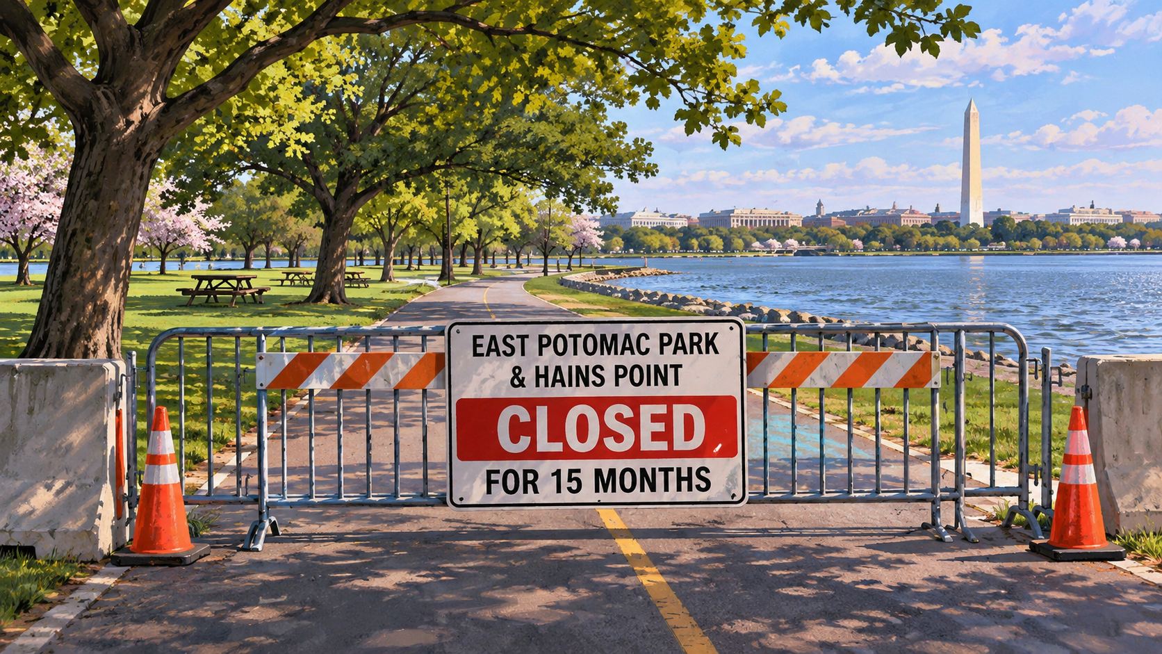
AI-generated editorial illustration of the East Potomac Park closure. Illustration
The National Park Service plans to close East Potomac Park south of Buckeye Drive, including Hains Point, Ohio Drive and the public golf course, on Sunday, November 15, WUSA9 and FOX 5 DC report. The government has said the closure would last about 15 months.
The Park Service says the park's seawall has "significant safety hazards" and is "currently crumbling into the Potomac River," leaving parts of the perimeter flooded, and that the closure would happen regardless of plans for the golf course. President Trump wrote on October 26, "We are closing the East Potomac Golf Course Site as scheduled on November 15th in order to renovate and rebuild," according to court filings described by WUSA9.
The DC Preservation League and two golfers, Dave Roberts and Alex Dickson, have asked U.S. District Judge Ana C. Reyes for a 14-day restraining order or stay. They argue the safety rationale is a pretext for the president's plan to rebuild the course, that seawalls at the Tidal Basin and West Potomac Park were rebuilt without closing those parks, and that the closure breaks federal environmental and historic preservation laws and the Park Service's own closure rules. A hearing is set for Friday, November 13.
D.C. lawmakers and park users planned a rally on Capitol Hill on Thursday. FOX 5 reports that a supplemental funding request before Congress includes $500 million for the Interior Department's construction account, some of it for seawall repairs, and that advocates want lawmakers to bar its use for the proposed championship course.
Check the Park Service's National Mall and Memorial Parks alerts before heading out this weekend; we will update this after Friday's hearing.
The department's 2026-2030 strategic plan pairs land sales with more workforce cuts, as a Senate permitting bill that critics say would lock in public-land approvals advances.
The Department of the Interior released a five-year strategic plan on Tuesday that says it "will work to decrease the size of the federal estate by offering to states, localities and Tribes the opportunity to purchase federal lands," Outdoor Life reports. The 28-page plan covers fiscal years 2026 through 2030.
According to the plan, proceeds from selling lands that are not "nationally significant" would go toward acquiring land for conservation and recreation elsewhere, "while at the same time decreasing the federal taxpayer's financial responsibility to manage federal lands." Outdoor Life's account of the plan does not identify specific parcels or the criteria for sale. It also says the department "will consolidate its workforce," adds staff only in law enforcement and public safety, and folds Interior's wildland fire programs into the new U.S. Wildland Fire Service.
"From a hunting and angling perspective, we love the places that are not of national significance," Ryan Callaghan, president of Backcountry Hunters & Anglers, told Outdoor Life. "I'd need to see the criteria for disposal, but at first blush this flies in the face of overwhelming positive appreciation and sentiment for America's public lands." He noted that state trust lands generally carry tighter rules on camping, driving and shooting than federal land.
In a letter introducing the plan, Secretary Doug Burgum writes that "for the first time in human history, we can turn electricity into intelligence." Outdoor Life has reported that the administration is weighing at least a dozen data center proposals on public land covering at least 17,600 acres in the West. Kate Groetzinger of the Center for Western Priorities called the plan an effort "to pillage our public lands in order to power AI data centers."
Separately, the Senate voted 73-25 on Monday, November 9, to begin debate on the Bipartisan American Affordability and Jobs Act (BAAJA), a permitting bill. The Center for Western Priorities says provisions in it would bar agencies from revoking most permits in effect on or after November 6, 2026, limit judges to ordering a new environmental review rather than halting a project, and let developers seek compensation if a future administration deliberately slows permits. The center, which opposes the bill, lists Bears Ears, the Tongass, the Boundary Waters and California's Mojave Desert among places it considers at risk. Debate in the Senate continues.
noticeBorder wall construction in the Big Bend regionBrewster and Presidio Cos., TexasSupreme Court lifted the Oct. 2 injunction on Nov 9; the lawsuit continueschecked Nov 9
The Supreme Court on Monday, November 9, cleared the way for the Trump administration to resume building a border wall in the Big Bend region of southwest Texas, which includes parts of Big Bend National Park, SCOTUSblog reports. In an unsigned order, the justices paused a federal district judge's order that had halted the project. Justice Ketanji Brown Jackson was the only justice to note that she would have denied the government's request.
U.S. District Judge Kathleen Cardone in El Paso had barred construction on October 2 "until and unless" the government complied with environmental and other laws. The plans include 30-foot steel barriers, patrol roads and surveillance systems, NPR reports. Homeland Security Secretaries Kristi Noem and Markwayne Mullin had issued waivers of environmental and conservation laws for the work, saying the area is one of high illegal entry; Cardone found that the Big Bend sector, more than 25 percent of the border, accounts for between 0.3 and 2.2 percent of apprehensions.
The Supreme Court wrote that federal law shows a "clear preference for expeditious border construction over the very harms respondents assert," according to NPR. The challengers are the Center for Biological Diversity, a nonprofit working to preserve a historic church near the border and a landowner who works as a river guide. "This decision greenlights the contractors and allows the bulldozers to come roaring back into the region," said Laiken Jordahl of the Center for Biological Diversity. The government had told the court that a gap in border defenses there would be "a dangerous magnet for cartels and other bad actors."
The lawsuit itself goes on in the lower court. The park has not announced any visitor closures tied to the construction; the Boquillas crossing, which reopened November 7, is on its Thursday-to-Sunday winter schedule.
Access Fund has bought the parcel holding the only practical parking area and trail to Phun Rock, a crag of more than 160 routes on Okanogan-Wenatchee National Forest land in Washington's Methow Valley, the group announced November 9. The land belonged to Outward Bound, which is closing its Mazama campus; Access Fund says it intends to transfer the parking area to the Forest Service for long-term ownership.
The Boquillas Port of Entry in Big Bend National Park, the crossing to the Mexican village of Boquillas del Carmen, reopened Saturday, November 7, after about three weeks closed, the Big Bend Times reports; the National Park Service now lists it as open. High water on the Rio Grande closed it by mid-October, and as of November 5 about 100 feet of the trail to the river was still covered in slick mud with no safe way around it.
The crossing is on its winter schedule, Thursday through Sunday from 9 a.m. to 4 p.m., and hours can change with weather and river conditions. Visitors need a valid passport and must meet entry requirements on both sides of the border.
The primitive area of Davis Mountains State Park in West Texas, across the highway from the park's main developed area, is closed November 7 through 10 for Texas Parks and Wildlife public hunts for aoudad, javelina and feral hogs, and reopens November 11, the Big Bend Times reports. The rest of the park is not affected. The primitive area closes again February 20 to 23 for another hunt.
Wild River State Park in Chisago County, Minnesota, is closed to the public November 7 through 9 for a special hunt, open only to hunters drawn for permits, the Chisago County Press reports; camping and day use resume Tuesday, November 10. The park is unrelated to the Wild River Fire in New Hampshire.
The Boquillas Port of Entry in Big Bend National Park, the crossing to the Mexican village of Boquillas del Carmen, stayed closed Thursday and Friday, November 5 and 6, after an inspection found about 100 feet of the trail to the Rio Grande covered in slick mud with no safe way around it, the Big Bend Times reports, citing the park. The crossing has been closed since at least October 17, when high water made the path unsafe. Park officials planned another inspection Friday evening to decide whether it can reopen Saturday. When open, its winter hours are Thursday through Sunday, 9 a.m. to 4 p.m.
closedBodie Island Light Station boardwalk and observation platform (lighthouse open)Cape Hatteras National Seashore, North CarolinaClosed from Nov 2 for about 120 dayschecked Nov 2
Cape Hatteras National Seashore closed the boardwalk and observation platform at the Bodie Island Light Station on November 2 for a rehabilitation expected to take about 120 days, finishing this winter if weather allows, the park said. The light station itself stays open. Crews will replace deteriorated boardwalk planks, cables and seating, repair the railings and treat the pilings against weather and sun, so expect construction equipment and contractors in the area.
advisoryPile burning: Big Stump, Grant Grove, Cedar Grove, Mineral KingSequoia and Kings Canyon NPs, CaliforniaNov 1 to Mar 15, conditions permitting; expect smokechecked Oct 30
Sequoia and Kings Canyon national parks will burn piles of cleared brush and small trees from November 1 through March 15, 2027, when weather, fuels, air quality and staffing allow, in the Big Stump, Grant Grove and Cedar Grove areas of Kings Canyon and the Mineral King area of Sequoia, the park said October 30. Expect smoke, burning piles, firefighters and equipment along park roads, and reduced visibility at times. The burning clears material from forest-restoration and defensible-space work that helps protect giant sequoias and park facilities from wildfire. Air quality updates are at fire.airnow.gov and valleyair.org.
Grand Canyon National Park is taking public comments through midnight November 11 on a plan to remove sections of the historic Trans-Canyon Telephone Line, which runs through the inner canyon along the Bright Angel and North Kaibab trails with a spur toward the South Kaibab. Rebuilt by Civilian Conservation Corps crews in 1935 and listed on the National Register of Historic Places, the line has loose, hanging and fallen wire that endangers helicopters during rescues and can entangle wildlife, the park says. It proposes removing wire where needed and marking what stays, while leaving the historic poles, cross-arms and insulators in place. Comments go through the National Park Service's planning website.
advisoryPrescribed burn, Eagle Cliff and Headquarters units (437 acres)Rocky Mountain NP, east side, ColoradoLate October onward, when conditions allow; expect smokechecked Oct 27
Rocky Mountain National Park and the U.S. Wildland Fire Service plan to burn about 437 acres on the park's east side, between the Beaver Meadows Visitor Center and Bear Lake Road and south of High Drive, when weather and fuel conditions allow, possibly starting late October. Burning will be spread over several days to limit smoke, which may be visible in Estes Park. The park says earlier fuel treatments helped keep the 2020 East Troublesome Fire and 2012 Fern Lake Fire from crossing Bear Lake Road and Trail Ridge Road; check the park's alerts before driving Bear Lake Road during the burn.
A black bear attacked a woman from behind early Sunday, October 25, as she walked her leashed dog in her backyard near Index in Snohomish County, knocking her down and biting and clawing her before she got inside and called for help, the Washington Department of Fish and Wildlife said. She was taken to a hospital with serious but non-life-threatening injuries.
Two black bears had been seen in the area, a large adult and a younger bear, possibly a sow with a cub. Fish and Wildlife officers and county deputies searched with dogs but did not find the animal; a trap has been set and patrols increased. It is the second black bear attack in Washington in a week, after a wounded bear injured a woman in Pend Oreille County on October 18.
In fall, bears are fattening up for winter and are drawn to garbage, pet and livestock food, bird feeders, fruit trees and grills; the department asks people near bear country to secure them. If a bear approaches, stand tall, wave your arms and talk in a low voice, back away and do not run. Keep dogs leashed, make noise on trails and carry bear spray you know how to use.
noticeMost park roads; West, South and East entrancesYellowstone National Park, Wyo.–Mont.–IdahoClose to regular traffic Nov 1; North–Northeast road stays openchecked Oct 23
Saturday, October 31, is the last day to drive most of the park this year. Only the North-to-Northeast road through Lamar Valley stays open all winter.
Yellowstone National Park closes its West, South and East entrances and nearly all park roads to regular vehicle traffic on November 1, the park said October 21. Saturday, October 31, is the last day visitors can drive most of Yellowstone's roads in 2026. The road from Tower Fall to Canyon Junction over Dunraven Pass stays open through October 31, weather permitting.
Through the winter, the only route open to cars is the road between the North Entrance at Gardiner, Montana, and the Northeast Entrance at Cooke City and Silver Gate, Montana, through Mammoth Hot Springs, Tower Junction and Lamar Valley. It stays open year-round, weather permitting. Snowmobile and snowcoach travel season starts December 15.
If you are going before the closure, expect limited services and changing weather, and closures that can happen without notice. Keep the gas tank full and pack blankets and cold-weather gear. Road conditions are on the park's Park Roads page, by text alert (text 82190 to 888-777) or by phone at 307-344-2117.
The fungal disease that has killed millions of bats was confirmed on the park's east side, a first for Glacier County. A vaccine trial there is under way.
Glacier National Park has confirmed white-nose syndrome in a dead little brown bat found in the Saint Mary area in May, and the fungus that causes it in several live bats sampled on the east side in June, the park said October 21. They are the first detections in the park and in Glacier County.
The disease infects bats while they hibernate, making them wake repeatedly and burn through fat reserves, often leading to starvation and death. Since it was found in New York in 2006 it has spread across North America. Glacier has 10 documented bat species, all insect-eaters that are also prey for raptors and weasels.
The park is part of a field trial of a vaccine against the disease: between 2024 and 2026, biologists tagged 529 bats, giving 265 the vaccine and 264 a placebo, to compare survival as they come out of hibernation.
For visitors, the usual precautions apply: do not handle bats, and decontaminate caving or climbing gear used where bats roost before using it elsewhere, following federal white-nose syndrome guidance. Report dead or sick bats to park staff.
Grand Canyon National Park is taking public comments through midnight November 6 on a draft agreement with Arizona's historic preservation office on ways to make the replacement water tank at Hermits Rest less visible. The 2022 tank was meant to look like the old one, but Arizona safety rules added a ladder, platform and cap that stand out in the Hermits Rest National Historic Landmark. The project is separate from the park's broader water system repairs; the draft and comment form are on the park's planning site.
noticeDenali Park Road vehicle rule, restricted section mile 15–90Denali National Park, AlaskaFinal rule Oct 15; up to 160 vehicles a day in seasonchecked Oct 15
The Interior Department and National Park Service have issued a final rule changing how many vehicles may use the restricted section of the Denali Park Road, from mile 15 to mile 90. Up to 160 vehicles a day may travel it during the visitor season, as long as the park's standards for resource conditions and visitor experience are met. That daily limit replaces the current cap of 10,512 vehicle permits a season.
The rule also fixes the season's end date. The season now always runs from the Saturday before Memorial Day through the second Thursday after Labor Day; language that could end it on September 15 in some years has been removed.
The agencies say the rule brings the regulations in line with the park's 2012 Vehicle Management Plan, which was developed with public input, and present it as part of an executive order on expanding access to national parks. Secretary Doug Burgum called it cutting red tape while protecting the landscape; Superintendent Brooke Merrell said it lets the park meet visitor demand while preserving its resources.
The road itself is about to reopen in full. The Pretty Rocks Bridge, which reconnects the east and west halves of the road after the 2021 landslide, was completed in September, and the park plans to restore public bus service to the west end in 2027. The release does not say how the daily limit will be divided among buses, permits and other users; check the park's road pages before planning a 2027 trip.
The public comment period on a supplemental proposal to redefine "waters of the United States," the term that sets which streams, wetlands and other waters fall under the federal Clean Water Act, closes Friday, October 9. The Environmental Protection Agency and the Army Corps of Engineers published the supplement in the Federal Register on September 9.
It builds on a proposed rule from November 2025, which the agencies say is meant to bring the definition in line with the Supreme Court's 2023 Sackett decision and make the program more predictable. That proposal drew about 220,000 comments. The supplement adds further regulatory options on parts of it, including how terms such as "relatively permanent" and "continuous surface connection" are defined, and how wetlands that are only intermittently connected to other water are treated.
The comment summary in the notice shows the split. Some commenters said the proposal follows Sackett; others said it would increase uncertainty and harm water quality. Several objected to leaving out ephemeral streams, which flow only after rain or snowmelt, citing the functions they serve; others argued the agencies' "wet season" test did not go far enough. The agencies note that waters falling outside federal jurisdiction can still be regulated by states. For anglers and hunters, the practical question is how much of the headwater and wetland habitat that supports fish and waterfowl stays under federal protection.
Comments must be received by October 9. File them at regulations.gov under docket EPA-HQ-OW-2025-0322, or email OW-Docket@epa.gov with the docket number in the subject line.
The Cibola National Forest is preparing an environmental impact statement on Roca Honda Resources' plan for an underground uranium mine on the Mount Taylor Ranger District, on National Forest, BLM, state and private land, and is taking scoping comments through October 14. The Forest Service expects the mine would need a project-specific amendment to the forest's land management plan. EPA Region 6 and BLM's Rio Puerco Field Office are cooperating agencies. Instructions for commenting are in the Federal Register notice, under project number 301824.
The Interior Department and the Fish and Wildlife Service are taking nominations through October 22 for the Hunting and Shooting Sports Conservation and Access Council, a federal advisory body that recommends policy to the Interior and Agriculture secretaries on habitat, hunting and shooting access on public land, and ranges. Among its duties is reviewing public land that is currently unreachable for hunting and recommending ways to open it. Anyone who applied under the April 21 call does not need to reapply. Submission instructions are in the Federal Register notice.
Starting today, the Bear Canyon Wildlife Management Area near Mimbres, New Mexico, is closed to all public access Monday through Thursday. It stays open Friday through Sunday for regular use. The New Mexico Department of Wildlife expects the weekday closures to last through the end of the year, with normal access back in January 2027.
The closures cover heavy-equipment work with the U.S. Army Corps of Engineers on a project that captures and holds sediment washing off the burned watershed. Hunters and anglers planning a midweek trip should move it to the weekend and watch for posted closure signs.
openCampfires with a permit, recreational target shootingShasta, Tehama, Butte, Siskiyou and Trinity Cos., CaliforniaSeasonal restrictions eased Oct 1checked Oct 2
The Bureau of Land Management has eased the seasonal fire restrictions on public land managed by its Redding Field Office, effective October 1. Recreational target shooting and campfires are allowed again, with a valid campfire permit, unless an area is posted otherwise. The restrictions had been in place since June 24.
The change covers BLM land in Shasta, Tehama, Butte, Siskiyou and Trinity counties. California campfire permits are free, online or at BLM, Forest Service and CAL FIRE offices.
Some rules do not go away. The statewide fire prevention order for BLM land in California stays in force all year. Tracer rounds and incendiary devices are not allowed, and shooters must pack out shells, brass and targets. The BLM reminds shooters that hot bullet fragments and exploding targets can start a fire.
This is BLM land only. National forests and state lands in the same counties set their own restrictions, so check with the agency that manages the ground you are on.
The next entrance-fee-free day at national parks is Tuesday, October 27, Theodore Roosevelt's birthday. Starting this year the waiver applies to U.S. citizens and residents only; visitors from abroad pay the normal entrance fee. Only the entrance fee is waived: camping, reservations and special-use permits still cost what they usually do. The last fee-free day of 2026 is Veterans Day, Wednesday, November 11.
Command of the Plaskett Fire on the Big Sur coast transfers back to Los Padres National Forest today, Tuesday, and the Timber Fire moves to Nevada Team 2, with the handover due to finish at 6 p.m. CAL FIRE says suppression repair is well along on all lines, crews are mopping up remaining heat along the Highway 1 corridor, and no fire spread is expected. A smaller team does not mean the land is open: the Monterey Ranger District closure that took effect Saturday stays in force through January 31.
closedMonterey Ranger District backcountry, Timber and Plaskett fire areasMonterey Co., CaliforniaOrder 05-07-51-26-11, through Jan 31, 2027checked Sep 26
Los Padres National Forest has issued a new emergency closure for the Monterey Ranger District, covering the Timber and Plaskett fire areas. Order 05-07-51-26-11 was signed September 25, takes effect today, and runs through January 31, 2027 unless the forest lifts or changes it sooner. It supersedes the order issued at the end of August.
The closure covers National Forest land in three pieces: the main backcountry area, the Brazil Ranch parcel north of Big Sur, and the Carmel River guard station. Inside them, being on forest land, forest roads or forest trails is prohibited. The order lists about sixty roads and nearly seventy trails. Among the ones people ask about most: Nacimiento-Fergusson Road, Tassajara Road, Arroyo Seco Road beyond the campground entrance, the Coast Ridge roads, Plaskett Ridge Road, and the Pine Ridge, Kirk Creek, Vicente Flat, Cone Peak and Big Sur trails.
Exempt are fire and rescue crews and officers on duty, landowners and residents getting to their own property unless an evacuation order is in place, and people holding a Forest Service permit that names them. Violations carry fines up to $5,000 for an individual.
Highway 1 and the state parks are not Forest Service land and are not governed by this order. The order's Exhibit B map shows the boundary; check it, and the state parks' own pages, before planning anything on the coast between Molera and Salmon Creek.
National Public Lands Day and National Hunting and Fishing Day both fall on Saturday, September 26. Volunteer projects run at parks and forests for the first; state wildlife agencies run free family events with open ranges and borrowed equipment for the second. Public Lands Day is not on the fee-free list for 2026 — volunteers at participating parks may be handed a fee-waiver coupon, in limited numbers and varying by park. The next fee-free date is Theodore Roosevelt's birthday on October 27.
The Fish and Wildlife Service rule that opened 1,450 hunting and fishing opportunities across 32 refuges and rescinded non-lead requirements at nine of them is still open for comment until October 1. We reported the rule and should have said so at the time. Also open: a Bureau of Land Management notice to amend the Vernal resource management plan for oil and gas leasing, to October 5; a proposed change to the Pacific halibut catch sharing plan, October 5; and a proposal to delist the Gila chub, which closes Thursday. Comment through the docket on the Federal Register listing rather than by email.
National Public Lands Day and National Hunting and Fishing Day both fall on Saturday. Volunteer projects run at parks and forests nationwide for the first; state wildlife agencies run free family events with open ranges and borrowed equipment for the second. The thing to remember, because it catches people every year: Public Lands Day is not on the fee-free list for 2026. Volunteers at participating parks may be handed a fee-waiver coupon, in limited numbers and varying by park. The next actual fee-free date is Theodore Roosevelt's birthday on October 27.
A policy overhaul took effect on January 1 and it has been reported badly enough that it is worth setting out plainly. The America the Beautiful pass now comes in two tiers. The $80 annual pass is the version you already knew, formally designated the resident pass, covering entrance and standard day-use at roughly 2,000 federal sites run by the Park Service, Forest Service, BLM, Fish and Wildlife Service, Bureau of Reclamation and the Army Corps.
The second tier is a $250 non-resident annual pass. Alongside it, eleven parks now charge non-residents a $100 per-person surcharge on entry. The resident pass exempts the holder from that surcharge, which is irrelevant to most American buyers and matters a great deal if you are travelling with someone who is not.
The wording is the part people get wrong, and it cuts in the generous direction: the surcharge applies to non-US residents, not non-US citizens. Permanent residents and green card holders pay the standard fee. If you live here and pay taxes here, your passport is not the question.
Fee-free days changed with it. There are eight this year and, since January, they apply only to citizens and permanent residents; a non-resident visiting on Constitution Day pays the entrance fee and any surcharge as normal. Passes bought before January 1 are honoured on their original terms until they expire.
One operational detail worth knowing before you drive up: Yosemite is now cashless at all entrance stations. Card or mobile payment only.
Constitution Day is one of the fee-free dates on the National Park Service calendar, so entrance fees are waived today. New for 2026, that waiver applies only to US citizens and permanent residents; non-residents pay the regular entrance fee and, at eleven parks, a $100 per-person surcharge on top. It is the last free date until Theodore Roosevelt's birthday on October 27, and National Public Lands Day on September 26 is still not on the list. Camping, tours, timed entry and backcountry permits are all payable as usual. Yosemite is now cashless at its entrance stations.
Correction, 2026-09-17. An earlier version of this brief said parks were free today without qualification. Fee-free days have applied only to US citizens and permanent residents since January 1, 2026. Corrected to add the residency restriction and the non-resident surcharge.
National Public Lands Day falls on Saturday, September 26, the 33rd time it has been held and the largest single-day volunteer effort on American public land. Organisers have stretched the event window to run from September 12 through October 10, and this year's theme is tied to the country's 250th anniversary.
The part worth knowing before you plan a trip: the Park Service's 2026 fee-free calendar does not include it. Eight dates carry free entrance this year, and September 26 is not among them. Volunteers at participating parks may be handed a fee-waiver coupon, but supplies are limited and the policy varies park by park. Call ahead rather than assume.
If a free gate is what you were after, the next one is close. Constitution Day, September 17, is on the list. After that the fee-free dates are Theodore Roosevelt's birthday on October 27 and Veterans Day on November 11.
The scale of the volunteer side is real. Last year more than 55,000 people turned out across some 900 events, work valued at $9.4 million. This year's signature event is a cleanup along the Lower Salt River near Mesa, Arizona.
The date has also become a focal point for a petition campaign against the sale or transfer of federal land, which is asking lawmakers to rule out sell-offs and state transfers while leaving room for small, specific exchanges.
Flash flooding through the Bright Angel and Phantom Ranch area at the end of August killed at least one person and left others unaccounted for. It also badly damaged the sole pipeline carrying water to millions of visitors a year, complicating a multi-year project already underway to replace the line. Check conditions and water availability before any inner-canyon plan this autumn.
The administration is proceeding with plans to rescind the quarter-century-old rule that has blocked road building, logging and other development across large stretches of national forest. Conservation groups and some members of Congress have pushed back, including a request to exempt specific states. If you hunt, ride or hike national forest, this is the rule change to follow.
The Interior Department announced a proposed rule on July 14 that would move day-to-day grizzly management to the four states where the bears live, while leaving them listed as threatened. The department framed it as recognition of recovery rather than a delisting, and the Secretary was explicit that responsibility, not status, is what moves.
The mechanism is a tiered system. How much decision-making and regulatory flexibility a state gets is tied to whether it has adopted conservation strategies and management plans and hit demographic objectives for the bears in its own country. Meet more of them, get more latitude.
This is the latest turn in a legal loop that has run for a decade. Wyoming, Montana and Idaho have petitioned for delisting repeatedly; two previous delistings were reversed in court. A settlement forced a final delisting decision, and that deadline now sits at the end of December.
The question most hunters will ask first is whether this opens a season. It does not, and not soon. The comment period on the rule closes September 15, and the separate delisting decision is still pending.